5 Best Hiking Trails In and Around Kelowna with Big Lake Views
Are you excited for stunning lake views, fresh air, and hidden gems in Kelowna? If so, this is for you!
The best hiking trails with lake views in Kelowna are closer than you think. Within a 20-minute drive from downtown, you can be standing above Okanagan Lake. This guide highlights five routes that reliably offer clear water views and photo-ready outlooks so you spend less time guessing which trail to choose.You’ll find planner-friendly details for each hike: exact distances, elevation gain, typical times and clear difficulty ratings. Routes cover Okanagan Lake and nearby lakeview options such as Kalamoir Regional Park, Bear Creek, Rose Valley Lake Loop and the Downtown Kelowna Waterfront. The guide also includes parking tips, GPS coordinates and recommended photo windows to help you pick the right trail for your fitness level, kids or dogs before weekend parking fills up.

If you like to know where you are at all times, you’re in luck. Here is something you may be interested in: https://www.alltrails.com. This app provides GPS tracking, directions to the trails, and a map display of your location on the route at all times.
Trails are categorized as: Nearby, Epic Views, Among Trees, Parks, Dog-Friendly, Wildflowers, Lakes, Rivers, Top Picks, Hidden Gems, Beaches, and Waterfalls. You can even click on a hike, get directions to the parking and the trailhead.
Always check the weather forecast, pack enough water, sunscreen and bug spray.
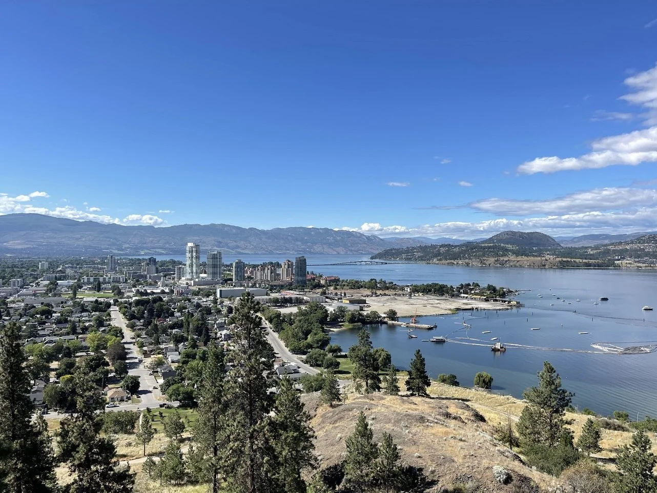
Knox Mountain: short hikes with Big Okanagan Lake Views
Knox Mountain is the easiest way to get downtown panoramas without a long drive. A short approach and brief climb put you above the city with clear views of Okanagan Lake. Choose the Apex Trail for a cardio push, Paul's Tomb for a quick photo-stop or Lochview for a quieter ridge walk.
Lochview is about a 3.3 km round trip with roughly 142 m elevation gain and typically takes 1 to 1.5 hours, rated moderate. The Apex Trail to the summit is about 2.4 km round trip with roughly 180 m gain and usually takes 45 to 60 minutes, strenuous. Paul’s Tomb is roughly a 1.6 km round trip with about 90 m gain and takes 30 to 45 minutes, easy to moderate.
Spring brings wildflowers, summer the clearest lake views, and early fall crisp air. Aim for sunrise or golden hour for the best photos, and watch toddlers or nervous dogs on steep or rocky sections.
Approximate Coordinates: 49°54'19.3"N 119°29'24.9"W
Park at the Knox Mountain Park lot off Knox Mountain Drive; weekend spaces fill early.
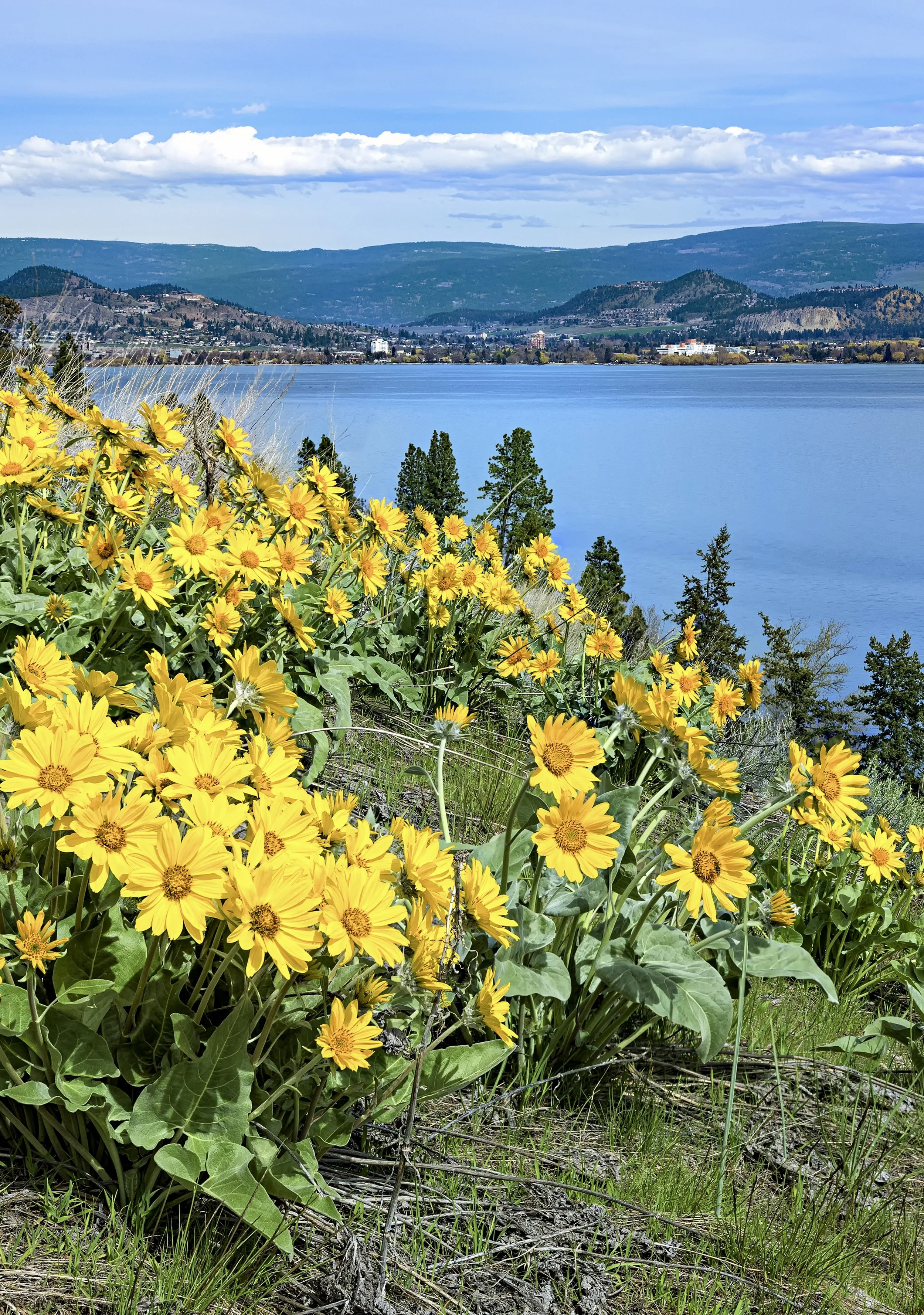
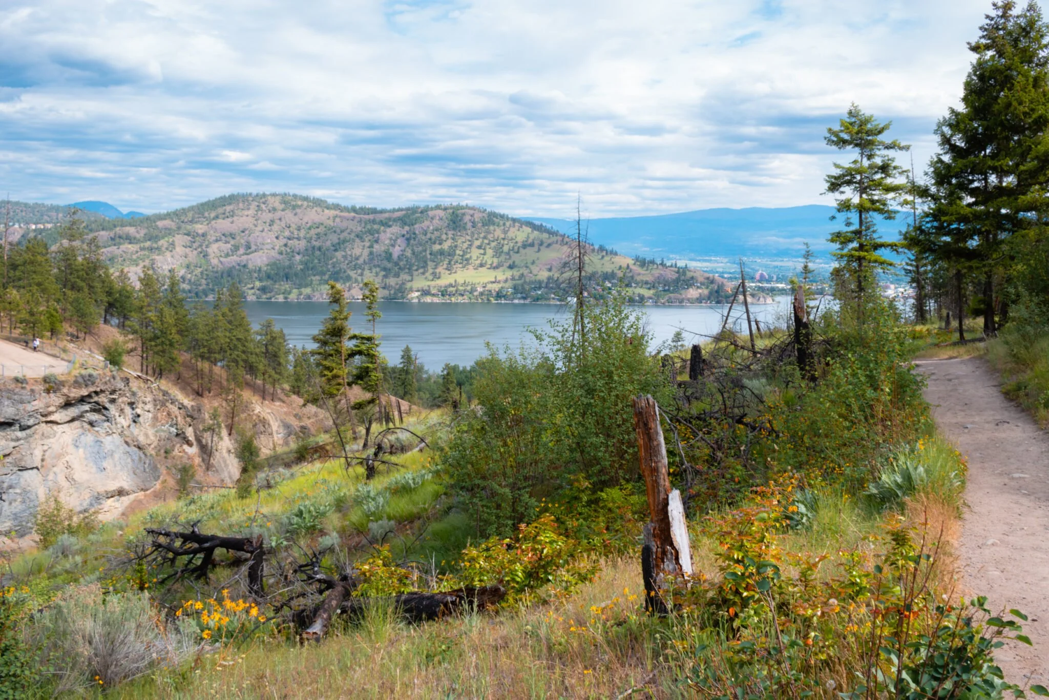
Kalamoir Regional Park loop: wildflowers & lakeside cliffs
Kalamoir mixes cliff lookouts with gentle shoreline walking, giving you dramatic Okanagan Lake views and easy beach access in a single outing. High, wide vistas and spring wildflowers are reachable without a long approach, so the park works well across seasons. Expect vivid blooms in May and June, full lake lines in summer and quieter walks in fall.
Loop options range from a short waterfront circuit of about 1.5 to 2.5 km with minimal elevation—suitable for strollers—to a full cliff-and-shore loop of 5 to 8 km with roughly 100 to 220 m of elevation gain, taking 1.5 to 2.5 hours, depending on breaks. Lakeside sections are easy, while cliff trails include rock steps and narrow ramps that need steadier footing and good shoes.
Small beaches along the route are fine for a quick late-summer dip, though water can stay cool earlier in the season; check local advisories before swimming.
Try early mornings or weekday afternoons to avoid crowds and bring a light layer if you plan to linger on one of the many spectacular park benches or cliffs.
Approximate Coordinates: 49°51'21"N 119°37'10"W.
The Main Parking Lot is a paved parking area at 3070 Collens Hill Rd, West Kelowna, BC.
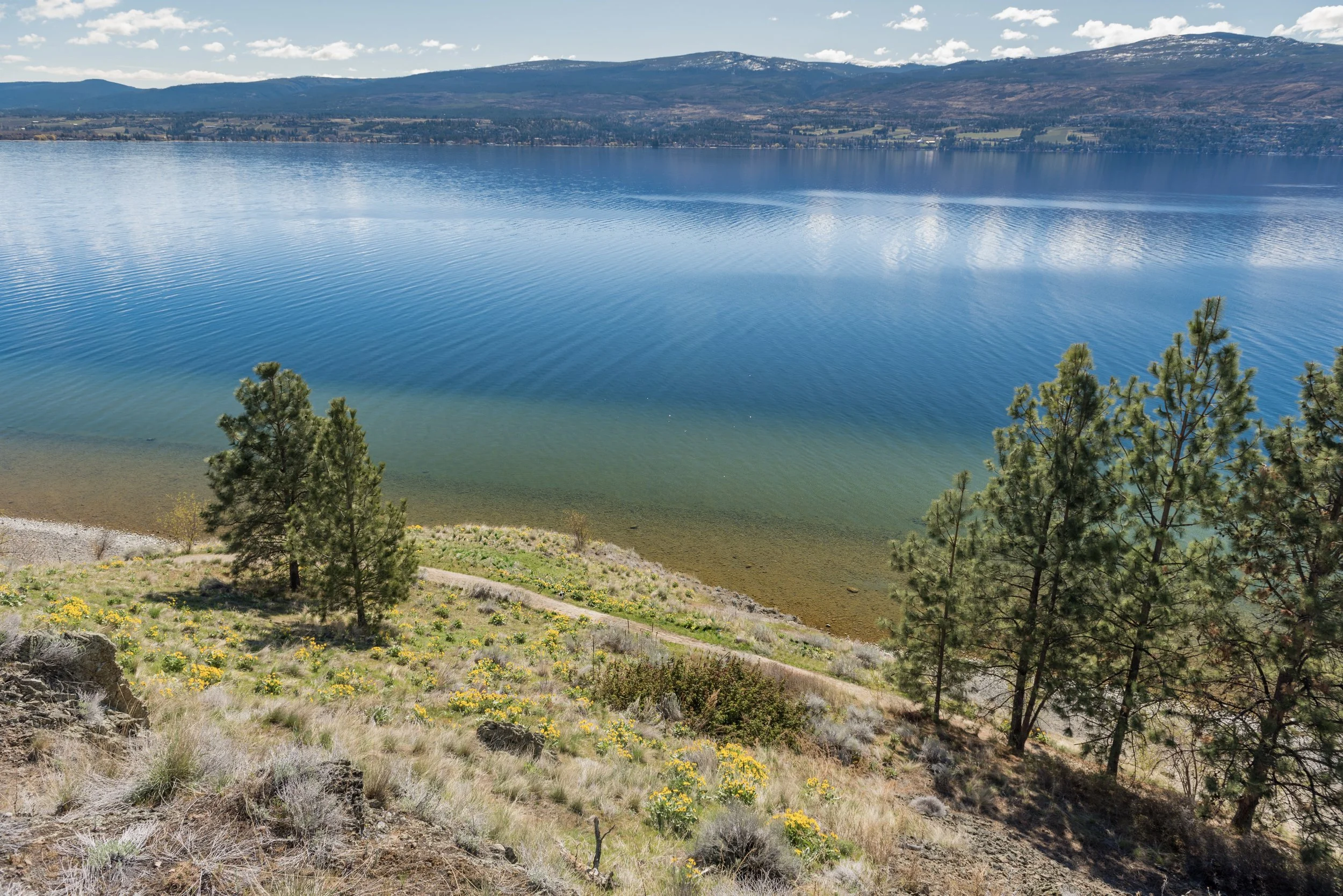
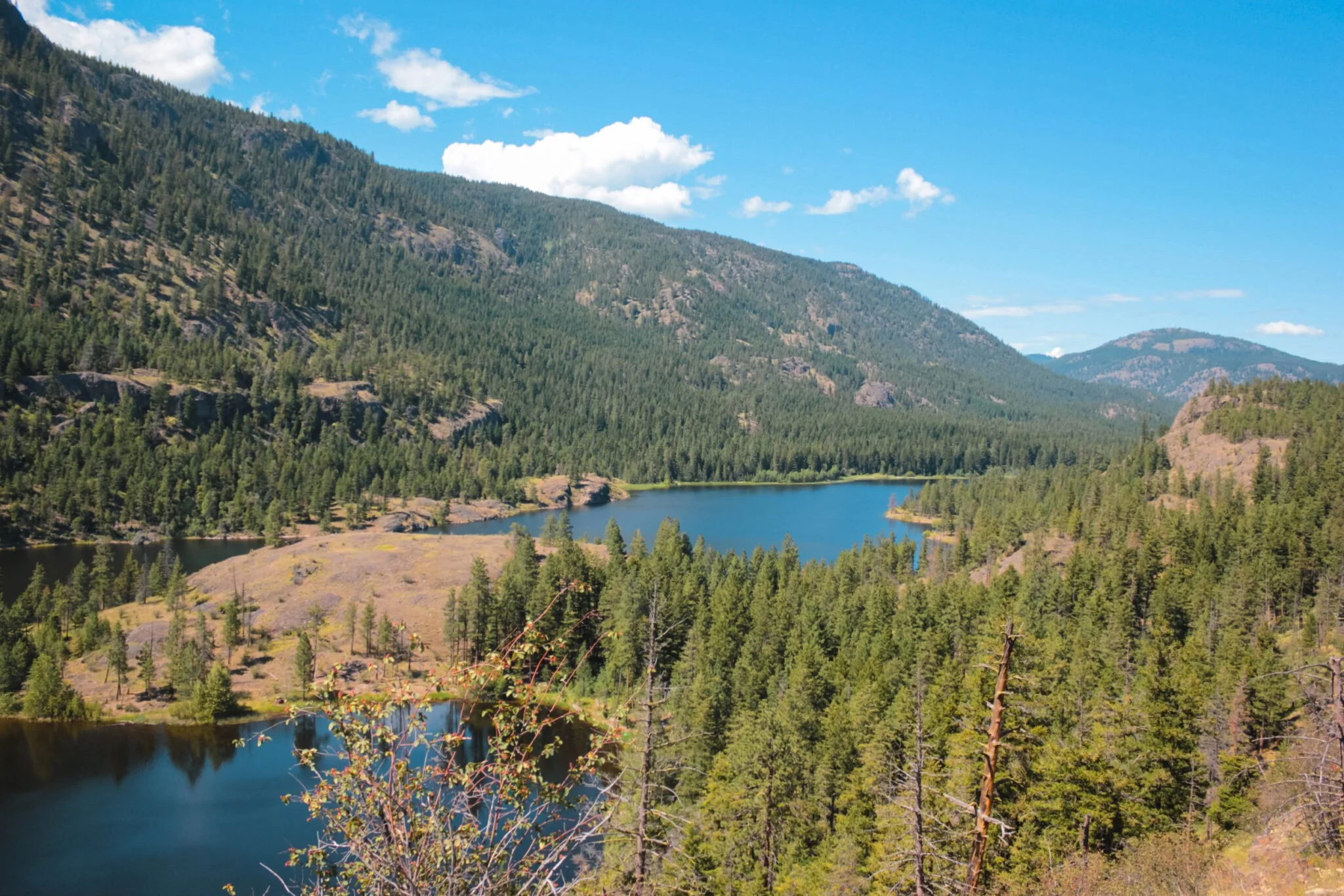
Rose Valley Lake loop: a quieter forested circuit with reservoir lake lookouts
Rose Valley Lake loop runs mostly through forest with framed lookouts back toward Okanagan Lake, making it a calmer alternative to busier waterfront trails. The route rewards hikers with shaded benches, a rustic shoreline, and clear-water vistas. It’s a good choice for people who want a relaxed outing away from the crowds.
Shorter outings are possible by cutting the loop in half and sticking to the shoreline, while longer distances can be achieved by linking nearby connectors toward Rose Valley Road. The steeper pitches are generally short and firm, but they can feel steeper when carrying a pack, so plan accordingly.
Best seasons are spring for wildflowers and early fall for mellow colour; watch for algae and slippery rocks if you plan a summer swim. Park at Rose Valley Road, where a small informal lot serves the trailhead. Arrive early on weekends because spaces are limited, and bring an offline map.
Approximate Coordinates: 49°51'0"N 119°33'36"W.
Main Parking Lot (Westlake Rd): Located on Westlake Road, across from the Firehall and near Rose Valley Elementary School (approx. 49.8844, -119.5600).
Bear Creek Routes: Ridge views and late-day light
Bear Creek’s ridgelines reward late-afternoon walks with long, slanted light and a wide valley perspective. Trails alternate among rocky-ridge walking, narrow-ledge viewpoints, and quick wooded transitions, so every turn shifts the mood from open panorama to sheltered forest. Several interconnecting routes give options for different abilities and time frames.
Common Routes Include:
Bear Ridge Loop: about 4.0 km with roughly 200 m gain, typically 1 to 1.5 hours and rated moderate. It’s a compact loop that delivers wide views and fits well into an evening schedule. Choose it for a short outing or a sunset walk when the light is best.
Upper Ridge to Summit Spur: about 8.5 km with roughly 550 m gain, taking 3 to 4 hours and rated hard. This route climbs higher and can include short scrambling sections that require good balance and fitness. Start early and bring extra layers to avoid afternoon weather changes.
Creek Connector + Ledge Out-and-back: about 3.5 km with roughly 120 m gain, usually 45 to 75 minutes and rated easy to moderate. It’s ideal for a late-afternoon stroll with strong light and accessible viewpoints. The short distance makes it a good family-friendly option if you skip exposed ledges.
Approximate Coordinates: 49°55'39.7"N 119°30'45.5"W
To reach the Bear Creek Provincial Park trails, located in West Kelowna, B.C. If you are travelling over the bridge on Hwy 97, right turn on Westside Road. The trails are roughly 7 kilometres north of the Hwy 97 junction, across from the camping area.
Typically small gravel lots with basic signage. Signage on smaller spurs can be variable, so download an offline map. Wear grippy footwear and carry layers since exposed sections, loose rock and sudden afternoon storms are common hazards.
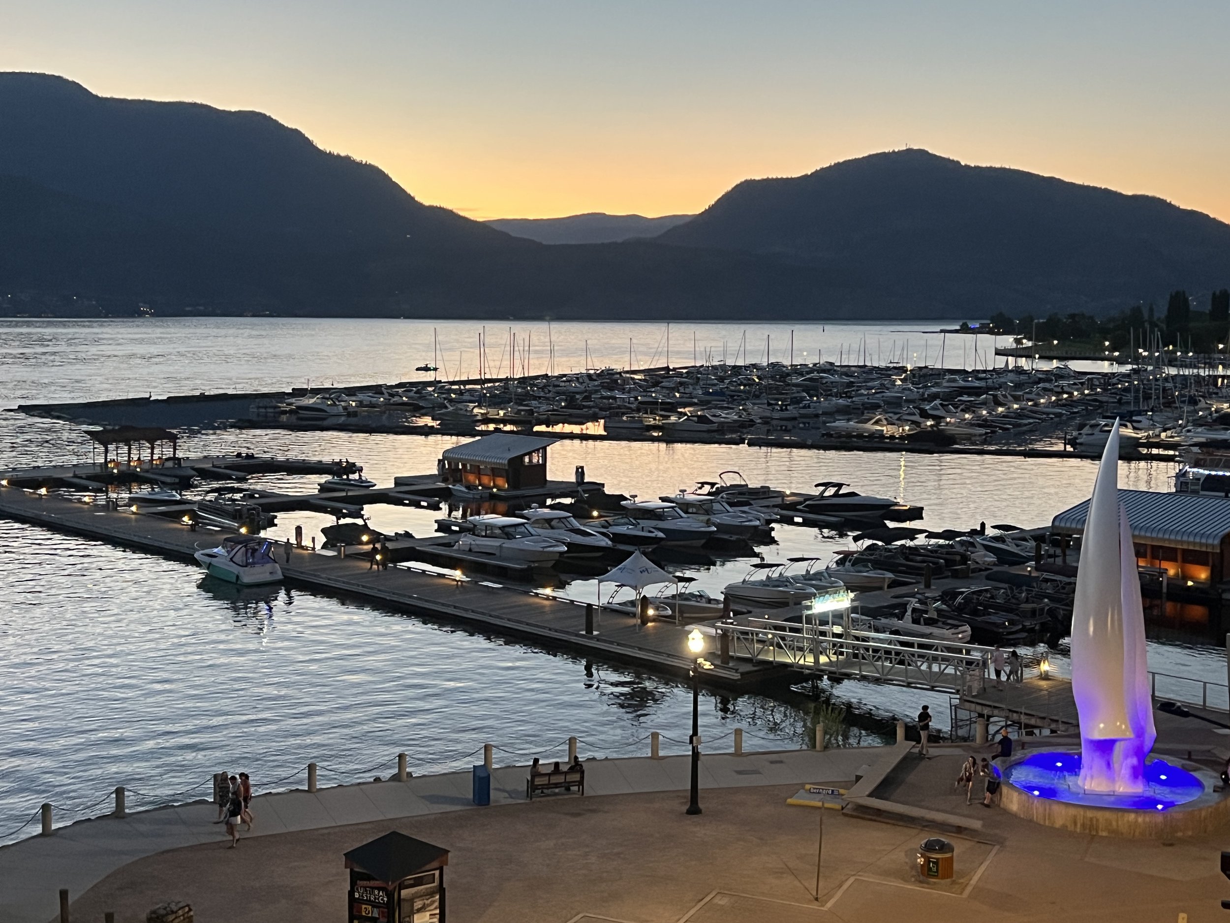
Kelowna’s Most Scenic Waterfront Stroll - City Park to Waterfront Park
The accessible waterfront trail connecting City Park to Waterfront Park is a low-effort, high-reward lakeside stroll that suits slow walkers, families, wheelchair users, mobility scooter users, and cyclists alike. Fully paved, wide, and gently graded, this shoreline pathway delivers uninterrupted views of Okanagan Lake without a single climb.
If you’re looking for maximum lake exposure with minimal exertion, this flat stretch fits beautifully into a relaxed morning or sunset outing. Plan an easy 2 to 4 km wander with plenty of pause points, or extend your walk by looping through downtown Kelowna’s waterfront plazas and marina boardwalks for a longer, meandering experience.
Park the Kelowna City Park Lot and head down to the sandy beach and grassy lawns, then follow the shoreline north past shaded benches, public art, and sailboats bobbing in the marina. Stop at the Kelowna Yacht Club Galley Coffee Shop with fire bowls and a view overlooking the masts in the marina. The route transitions seamlessly into Waterfront Park, where landscaped gardens and open green space create natural rest stops. Washrooms, water fountains, and seasonal concessions make this one of the most user-friendly waterfront walks in the Okanagan.
Access is straightforward, with multiple paved entry points and generous parking near both parks. Bike racks are plentiful, and the surface is smooth enough for strollers and wheelchairs. BC Transit stops are within a short walk for those planning a one-way outing.
Early mornings bring calm water and soft light for photography, while late afternoons offer glowing sunsets over the lake. Summer weekends can be lively, so quieter visits are best midweek or outside peak midday heat.
Family-friendly and dog-friendly (on leash), this waterfront corridor makes it easy to pair your walk with a beach dip, picnic, or patio stop downtown. In the summer months, information about free outdoor concerts along the route can be found here https://festivalskelowna.com/program/parks-alive/.
For the best ice cream in town, visit Parlours Ice Cream at Abbott Street and Bernard Ave, right across the street from the iconic Sails Sculpture.
It’s simple, scenic, and entirely accessible — Kelowna’s classic lakeside experience without the effort.